Lake Hood, Alaska Webcamera
October 20, 2013
Lake Hood Seaplane Base (ICAO: PALH) is a state-owned seaplane base located three nautical miles (6 km) southwest of the central business district of Anchorage in Alaska.
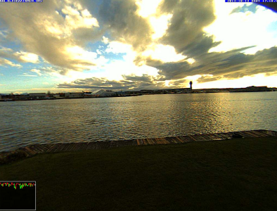
Operating continuously and open to the public, Lake Hood is the world’s busiest seaplane base, handling an average of 190 flights per day. It is located on Lakes Hood and Spenard, next to Ted Stevens Anchorage International Airport, three miles from downtown Anchorage. For 12-month period ending August 1, 2005, the seaplane base had 69,400 aircraft operations, an average of 190 per day: 88% general aviation, 12% air taxi and <1% military. There are 781 aircraft based at this seaplane base: 97% single engine and 3% multi-engine.
The city is on a strip of coastal lowland and extends up the lower alpine slopes of the Chugach Mountains. Point Campbell, the westernmost point of Anchorage on the mainland, juts out into Cook Inlet near its northern end, at which point it splits into two arms. To the south is Turnagain Arm, a fjord that has some of the world’s highest tides. Knik Arm, another tidal inlet, lies to the west and north. The Chugach Mountains on the east form a boundary to development, but not to the city limits, which encompass part of the wild alpine territory of Chugach State Park.
The city’s seacoast consists mostly of treacherous mudflats. Newcomers and tourists are warned not to walk in this area because of extreme tidal changes and the very fine glacial silt. Unwary victims have walked onto the solid seeming silt revealed when the tide is out and have become stuck in the mud.
LAX Airport Los Angeles, USA Webcam
August 25, 2012
Los Angeles International Airport (IATA: LAX, ICAO: KLAX, FAA LID: LAX) is the primary airport serving the Greater Los Angeles Area.

In 2011, LAX was the sixth busiest airport in the world after Hartsfield-Jackson Atlanta International Airport, Beijing Capital International Airport, London Heathrow Airport, Chicago O’Hare International Airport, and Tokyo Haneda International Airport with 61,862,052 passengers.
The “Imperial Hill” area (also known as Clutter’s Park) in El Segundo from which the South Complex of the airport can be viewed is a prime location for aircraft spotting. Another spotting location sits under the final approach for runways 24 L&R on a lawn next to the Westchester In-N-Out Burger. This is one of the few remaining locations in Southern California from which spotters may watch such a wide variety of low-flying commercial airliners from directly underneath a flightpath.
The distinctive white “Theme Building”, designed by Pereira & Luckman architect Paul Williams and constructed in 1961 by Robert E. McKee Construction Co., resembles a flying saucer that has landed on its four legs. A restaurant with a sweeping view of the airport is suspended beneath two arches that form the legs. The Los Angeles City Council designated the building a cultural and historical monument in 1992. A $4 million renovation, with retro-futuristic interior and electric lighting designed by Walt Disney Imagineering, was completed before the “Encounter Restaurant” opened there in 1997.
KLAX live audio feed courtesy LiveATC.net
Malmö, Sweden Webcam
August 12, 2012
Malmö in the southernmost province of Scania, is Sweden’s third largest city by population after Stockholm and Gothenburg, and is one of the largest cities in Scandinavia.

Malmö was one of the earliest and most industrialized towns of Scandinavia, but it struggled with the adaptation to post-industrialism. Since the construction of the Öresund bridge, Malmö has undergone a major transformation with impressive architectural developments, attracting new biotech and IT companies, and particularly students through Malmö University College.
In the 15th century, Malmö became one of Denmark’s largest and most frequented cities, reaching a population of approximately 5,000 inhabitants. It became the most important city around the Øresund, with the German Hanseatic League frequenting it as a marketplace, notable for its flourishing herring fishing. During that time, the city arms were granted in 1437 by King Eric of Pomerania. It was based on Eric’s own arms from Pomerania: an argent with a griffin gules. It gave the griffin’s head to Malmö, eventually this extended to the entire province of Scania.
Oresundtrains cross Øresund Bridge every 20 minutes (every 10 minutes during rush hour) connecting Malmö to Copenhagen, and the Copenhagen Airport. Also some of the X 2000 and Intercity trains to Stockholm, Gothenburg, and Kalmar cross the bridge, stopping at Copenhagen Airport.
Vidlin, Shetland Islands Webcam
June 18, 2012
Vidlin (from Old Norse: Vaðill meaning a ford), is a small village located in the Shetland Islands of Scotland.

Shetland has three National Nature Reserves, at the seabird colonies of Hermaness and Noss, and at Keen of Hamar to preserve the serpentine flora. There are a further 81 SSSIs, which cover 66% or more of the land surfaces of Fair Isle, Papa Stour, Fetlar, Noss and Foula. Mainland has 45 separate sites.
The landscape in Shetland is marked by the grazing of sheep and the harsh conditions have limited the total number of plant species to about 400. Native trees such as Rowan and Crab Apple are only found in a few isolated places such as cliffs and loch islands. The flora is dominated by Arctic-alpine plants, wild flowers, moss and lichen. Spring Squill, Buck’s-Horn Plantain, Scots Lovage, Roseroot and Sea Campion are abundant, especially in sheltered places. Shetland Mouse-ear (Cerastium nigrescens) is an endemic flowering plant found only in Shetland.
Shetland has numerous seabird colonies. Birds found on the islands include Atlantic Puffin, Storm-petrel, Red-throated Diver, Northern Gannet and Bonxie. Numerous rarities have also been recorded including Black-browed Albatross and Snow Goose, and a single pair of Snowy Owls bred on Fetlar from 1967 to 1975.
Ny-Ålesund Airport, Svalbard Norway Webcamera
May 28, 2012
Ny-Ålesund Airport is an airport serving the research community of Ny-Ålesund in Svalbard, Norway. The airport is owned by Kings Bay, who also owns the company town.

The need for an airport to support commercial activity in Ny-Ålesundits arose in 1965 with the construction of Kongsfjord Telemetry Station. The Royal Norwegian Council for Scientific and Industrial Research needed to have an aviation connection with Longyearbyen to send magnetic tapes with the downloaded data to Germany. A road was built from the settlement to Hamnerabben, the site of the telemetry station. The top of the hill was sufficiently flat that a runway could be constructed. It was built by giving a 2,790 ft long straight section of the road a width of 130 feet. Waste oil was poured on the gravel to bind it.
Also located in this archipelego is the Svalbard Global Seed Bank which is is a secure seedbank located on the Norwegian island of Spitsbergen near the town of Longyearbyen in the remote Arctic Svalbard archipelago, about 810 miles from the North Pole. The facility preserves a wide variety of plant seeds in an underground cavern. The seed vault is an attempt to provide insurance against the loss of seeds in genebanks, as well as a refuge for seeds in the case of large-scale regional or global crises. Spitsbergen was considered ideal due to its lack of tectonic activity and its permafrost, which will aid preservation. The location 430 ft above sea level will ensure that the site remains dry even if the icecaps melt.
Playa Kantenah, Mexico Webcam
April 23, 2012
Playa Kantenah, near Akumal, is a small beach-front tourist resort community south of Cancún Mexico.

Akumal means “place of the turtles” in the Mayan language. Playa Kantenah is located in the state of Quintana Roo. Part of the Yucatán Peninsula, it is one of the most forested areas of the world when considering biotic mass per hectare. There are four generalized ecosystems in Quintana Roo—tropical forests, or jungle, savanna, mangrove forests, and coral reefs. Biological experts consider the coastline of Quintana Roo one of the best manatee habitats worldwide.
Quintana Roo is home of the world famous city of Cancún, the islands of Cozumel and Isla Mujeres, the towns of Bacalar, Playa del Carmen and Akumal, as well as the ancient Maya ruins of Chacchoben, Coba, Kohunlich, Muyil, Tulum, Xel-Há, and Xcaret. The Sian Ka’an Biosphere Reserve is also in the state.
The statewide population is expanding at a rapid rate due to the construction of hotels and the demand for workers. Many immigrants come from Yucatán, Campeche, Tabasco, and Veracruz. The state is frequently hit by severe hurricanes due to its exposed location, the most recent and severe being Hurricane Dean in 2007, making landfall with sustained winds of 280 km/h (175 mph), with gusts up to 320 km/h (200 mph).
Santander, España Camera
February 27, 2012
The port city of Santander is the capital of the autonomous community and historical region of Cantabria situated on the north coast of Spain.

The city owes its existence to the excellent harbour of the Bay of Santander. Santander was an important port for Castile in the later Middle Ages, and also for trade with the New World. It officially became a city in 1755. In the early 1900s Santander became the favoured summer residence of King Alfonso XIII, who built the Palacio de la Magdalena as the residence of the royal family during the holidays.
Santander has a great tradition and cultural activity, with events that play an important role in cultural and social life of the city. Is a major international university summer UIMP and organizes large festivals of music and dance, as the Festival Internacional de Santander.
Paseo de Pereda is an ancient pier and promenade overlooking the Santander bay and the towns of Somo and Pedreña. Cafés can be found where, in the past, traders, military, and writers such as Pereda himself would meet. The Gardens, also named for him, are the monument to the writer José María de Pereda, and display references to his works.
Guaymas, Mexico Webcam
February 24, 2012
Guaymas is a city in the southwest part of the state of Sonora in northwestern Mexico, and south of the state capital of Hermosillo, 242 miles from the U.S. border.

Before the arrival of the Europeans, the areas now known as Guaymas was dominated by the Guaymas, Seri and Yaqui tribes.In 1539, two Spanish ships, the Santa Agueda and El Trinidad, arrived to Guaymas Bay. In the late 18th and early 19th century, there was supposedly only one inhabitant in Guaymas, called “Tio Pepe” (Uncle Pepe), who was said to be a drunk and a thief.
Guaymas is basically an industrial and shrimp-fishing port which has conserved a number of historical attractions. Buildings in the historic center have a mix of Neoclassical and Moorish facades, however many are in disrepair. The city has two main plazas, one called 13 de Julio, which is nicknamed the “plaza de los flojos” (lazy men’s plaza) for the large number of people who relax there.
The Guaymas-Empalme station for space observations is about six miles east of Empalme, Sonora, adjacent to Mexican Federal Highway No. 15. It is operated by the Mexican Space Agency. As a major link in the NASA‘s worldwide Manned Space Flight Network, the Guaymas Tracking Station, built in 1961, played a key role in tracking American manned space flights in the Mercury, Gemini, and Apollo programs through Apollo 13.


